I don’t FEEL ready… though to be fair, I’m not. I’m ready ENOUGH, which is all that matters at this point. There’s no way to 1000% prepare for something. I feel you can get CLOSE, but not all the way. Maybe one day that’ll change. I hope that one day that’ll change.
I wish I had a longer backpacking trip under my belt. Preferably more Spanish practice. Preferably more time hiking / running. Preferably more wool clothing. Preferably a better camera, and a better working knowledge of how to save weight while traveling.
But it’s ok. I’m not there YET. This trip will be a learning experience to the utmost. It will be eye opening to experience another culture to a level I’ve never experienced before. It will be chaotic. There’s a decent chance I’ll get robbed. Memories WILL be made (good and bad, no doubt). I’m gonna meet some awesome people. I’m gonna learn SO MUCH about travel. About backpacking across mountains. About my limits.
I am putting good energy into the universe, and I can only hope it gives me some back. I respect whatever it chooses.
I love reading negative reviews of National Parks. Why? Because people will always find a way to complain about anything. On rare occasion the reviews are valid, but most of the time it’s from people who never did their research in the first place. My personal favorite about Mammoth Cave is someone complaining that the name has nothing to do with the animal, and is “for branding purposes only.” I can only hope that one day they realize that ~a few~ words in the English language have multiple meanings. In the meantime, I will be making this post as a 5-star review of the park, to make up for their negative one.
Back at the end of July, my two-week road trip was coming to an end (yes, it took me 6 months to make this post) but I knew it wasn’t complete until I got the chance to visit Mammoth Cave National Park. Just a week earlier I had visited Indiana Dunes National Park and so I was particularly psyched to hit TWO parks in one trip.
I was staying in Louisville, which is only about an hour and a half drive from Mammoth Cave. Knowing this going into the trip, I had planned accordingly to make sure everyone going had booked for our tour ahead of time. The NPS offers a self-guided tour, but it doesn’t go very deep into the cave, nor does it cover an ounce of what you learn from a guided tour. I would highly recommend booking your tour ahead of time- there’s no way to know if / when the tickets will sell out.
Ye Olde Historic Tour
The standard tour is called the “Historic Tour” which is what my family decided to do. Nice, simple, a classic. They have a TON of different tour options though, so if you’re looking for something that’s a little more ~advanced~ or focuses on a specific theme, definitely go for that instead.
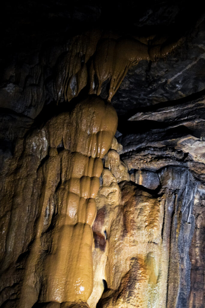
The Historic Tour was enthralling. I’ve been in caves before, but nothing nearly as grand as Mammoth Cave. I feel like when most people picture a “cave” they think something small, tight, cramped, claustrophobic. While there was a fair bit of ducking involved, and some of the tightest areas are rightfully named “fat man’s misery” and “tall man’s agony,” about half of the tour doesn’t require any of that. In fact, the entrance of the cave, and some of the main areas are a stark contrast to the more cramped parts, with walls easily 40-50 feet high.
As a rock climber, it took all of my mental energy to not try to try climbing the rock. ALL of it.
Perhaps the funniest aspect of the entire historical tour are the restrooms, conveniently located at about the midway point. That’s right. Bathrooms. At least 150 feet under the earth’s surface. Just kinda, there, in case you gotta go. Better in there than one of the offshoots of the cave I suppose.
Next time I go to Mammoth Cave, I’m gonna do one of their longer, proper caving tours because I think that’d be dope as heck. At LEAST I’ll do a longer tour, maybe 2.
Hiking In Mammoth Cave… the Park that is
One thing I wish the NPS highlighted on their website more was the hiking available within the park. My mom, sister, and I got there with plenty of time to spare before the tour so we could explore the park in its entirety, and I’d looked online and ~knew~ there were hiking trails, but they don’t give you too much information on them through the website/ the maps accessible in the visitor center are not available online (to the best of my finding abilities). That’s not to say they don’t have maps online (they do), they’re just not the ones at the Visitor’s Center, and those have a TON of information on the trails.
Cedar Sink Trail in Mammoth Cave National Park
All that being said, I highly recommend checking out some of the trails in the park– the two we got to check out were the Cedar Sink Trail and The River Styx Spring Trail. The Cedar Sink Trail was arguably as fascinating as the cave itself. It’s a short loop, only about a mile or so in length, and goes through this ENORMOUS sinkhole. There are stairs (this is your warning) that wind down one side of the sinkhole, and come back up on the other. The rock formations formed by the sinkhole are captivating- they jut out from the sides of the sinkhole in sharp edges, almost as though they were carved. There are a few entrances that look as though they lead to the cave system underneath, barricaded by wooden planks.
The River Styx, Followed by a Performance from Zeus
The River Styx
We hiked The River Styx Spring Trail after the tour, and that was …. chill, I’d say. It’s about .5 miles from the cave entrance, if that. The coolest thing was undoubtedly the tiny pond/pool that formed in a kind of…. mini sink hole? It sounds stupid when explaining, so please reference the picture for a glimpse of the magic.
To top off the day, on our drive back to Louisville, we got to drive past the most intense thunder storm I’ve ever seen. The whole sky was lighting up every couple of seconds. I get where the Greeks get their stories of the gods from. Zeus was there and he was angry. I don’t think I’ve ever seen a thunder storm remotely like it living on the East Coast. Simply does not compare. And of course photos and videos just don’t capture the raw violence of a storm like that. It’s just not enough. Fortunately, did NOT see any tornados while in tornado alley. An adventure for another time, perhaps.
Plopped right on the southern part of Lake Michigan, Indiana Dunes National Park is hands-down one of the most beautiful places I’ve been. Never thought I’d ever feel that way about a Great Lake, but here we are.
Up until actually GOING to Lake Michigan, I felt overall pretty “meh” about the Great Lakes. Like, I get it, they’re big. But what makes them so great? On my quest to visit all the National Parks, I deemed it only reasonable to visit Indiana Dunes while visiting my friend in Chicago, since it’s only a little over an hour outside the city. All of Chicago is only one hour from a slice of paradise. That might sound a little tongue-in-cheek, but I assure you it’s not. In fact, I’ll prove it to you.
The Cowles Bog Trail at Indiana Dunes
Indiana Dunes National Park is known for a few things. Namely, the dunes. The tallest one, Mount Baldy, is over 120 feet tall. That’s pretty freaking tall. While the park is named for the dunes, I honestly believe the beaches are the real highlight of this beautiful park.
Indiana Dunes during Golden Hour
When Jaye, their roommate Elena, and I parked at the trailhead for the Cowles Bog Trail, we weren’t expecting anything mind-boggling. It’s a short, 5 mile loop that’s recommended by the NPS for it’s stunning ecological diversity. There’s a bog (shocking), ponds, marshes, and TONS of mushrooms. They encourage hikers to pack a lunch and vibe at the beach for a while. We thought we’d do the hike and then drive to the public beach, 5 minutes down the road, to swim. It turned into a bit more of an adventure than that.
Trekking through sand and up a dune is mildly challenging, since every step slides you backwards a good quarter-step. If you’re hiking at a typical pace, I don’t think it would take very long to get to the shore, since it’s only about a mile and a half from the trailhead. However, the three of us were VERY intrigued by the mushrooms scattered along the path. We stopped approximately every nine feet to go, “OH LOOK AT THAT ONE it’s so PRETTY,” followed by Jaye taking out their phone to find out what mushroom it is with an app, Seek. Totally worth it. We found SO many beautiful mushrooms, including a few Indigo Milk Caps, which are light blue/white on top and deep blue under the cap.
Like, the Opposite of the Jersey Shore
As we hiked on towards the beach we gradually began to hear waves lapping against the shore. We rounded a bend near the summit of a sand dune and suddenly this incredible view of Lake Michigan materialized. The lake was a deep cerulean, with whitecaps dotting the waves. A sandy beach completed the scene and I felt like I was on a deserted island. The grove we were in was luscious and varying shades of green abounded– a stark contrast to the beach a mere quarter mile away. The beach itself was empty– there were no people near the lake. We could’ve been in the Caribbean, explorers of a lost land.
After taking a few pictures and videos of the scene, I started sprinting down the sand dune, overcome with excitement; Jaye and Elena mere paces behind me. We ran to the beach, kicked off our shoes, and dipped our toes in the water, a kind cool compared to the eighty-five degree sunny day we were having. Wanting to fully immerse ourselves in the water, we quickly changed into our bathing suits and hopped in the lake. I’ve never been so happy to be in the water. I’m not usually a water person but something about the energy of everything, the temperature of the water, the overwhelming feeling of freedom… it hit me. I felt on top of the world.
Lake Michigan
Perhaps the feeling was because it was such a striking contrast from what I usually experience going to a beach. There were none of the usual shore crowds, no vendors trying to sell me a chance to win a stuffed animal I could buy for three bucks at a local Walmart, no screaming children. There are trees instead of parking lots. Lake Michigan is freshwater meaning it’s not sticky like the ocean, and neither is the sand. You don’t have to worry about seaweed, sharks, or generally slimy things touching your feet.
We swam for a while, diving through waves, and splashing each other. After tiring ourselves out, we decided it was time to go back to shore, dry off, and tan. After re-applying sunblock for the third time, we ate our packed lunches and vibed. At one point, Jaye went back by the water, where a monarch butterfly washed up right on their foot! They brought it back to Elena and myself, and the three of us decided that even though it was probably going to die, we wanted to make its last moments as comfortable as possible. Imagine our surprise when it dried off and flew away!! Such a warm feeling.
Cattails are Invasive??? As it Turns out, Yes.
A handful of people eventually started to show up so we decided that it was time to move on. There were a few other things we wanted to check out, so we packed up and continued on the trail. The hike back from the beach is a million times more exhausting because now you’re hiking straight up a massive sand dune. Which is, again, not easy.
At one point, we came across several park rangers, dressed up in what looked similar to bee-keeper uniforms in the middle of the bog. They had these weird backpack things on them, with long spouts. It appeared they were introducing some kind of chemical into the bog. Entry points into the bog had signs and chains across them, closing off the trails. As the park rangers started to make their way towards us (we were near their truck), we resolved we wanted to learn more information. When they approached, we inquired as to what they were up to. They informed us they were weed killing invasive cattails. I didn’t know cattails were invasive?? But apparently they are, and it’s been something that’s been an issue for several years. After talking for a few more minutes, we continued our hike back.
Lunch pt 2. Linner?
We arrived back at the car tired but happy. A short drive to the visitor center later, we had more info of what else we could check out. But first: FOOD. One of the rangers recommended checking out a nearby town called Chesterton which had a lot of food options. After a bit of Googling, we found a place called Gastro 49 and drove there.
Food after a long hike and being at the beach just hits different. Iykyk. The three of us inhaled our meals in 10 minutes flat, then walked next door to an ice cream place. Ice cream was a necessity at that point, so that’s what we got.
Other Perks of Indiana Dunes
The day wasn’t over yet. While at the visitor center, we came across information on some historical places in the park– the Bailey Homestead and Chellberg Farm. You may recall some adventures Jaye and I have been on to various abandoned places (check out Pines Resort and Concrete City!), so this was right up our alley. We parked at the Little Calumet River Trail lot and walked to the homestead. They’re doing renovations, so we couldn’t go in, but we still got to wander around and look through some windows! Give it a few years I’ll bet they’ll have tour options. The Chellberg Farm was also interesting–they DID have tours there, but not when we went. Next time I go to Indiana Dunes I’ll be sure to go with a reservation so I can learn more about the farm life there.
Sunset and the City of Chicago
We made our final stop of the evening at West Beach- one of the official places you can swim in at Indiana Dunes (whoops)- to watch the sunset. There were numerous other people with the same idea, so we walked a bit to where it was less crowded. I got my camera out and started snapping away. The view was astounding- the sun set near the city of Chicago, slightly off to the West. I’m sure that in certain times of the year the sun sets right over the city of Chicago, which would 1000% be worth checking out at some point. Y’all already know how beautiful sunsets are. Words and pictures simply cannot capture their beauty. We watched as the sun got lower and lower in the sky, getting larger and more orange as it sunk towards the horizon. Finally, with one last twinkle, it dipped out of view.
Before it got too dark, we decided to spend the last few moments of our day tossing a frisbee back and forth, soaking in each other’s company. This was one of those days that I’ll never forget. Everything that could go right, went right. The only thing that went wrong was when we found out that the lake was closed to swimming due to an E. Coli issue. Which we never read because we were swimming in a part of the lake where there were no signs. Whoops. Fortunately none of us got sick. I’d do it again even if we got sick tbh, because that was undoubtedly one of the coolest adventures of my life.
One day I’ll return to Indiana Dunes and explore more of what the National Park has to offer. This was my second National Park, and already I’m overwhelmed at the idea of what the other parks have in store. Indiana Dunes was jaw-droppingly beautiful, a hidden gem as far as National Parks go (I’d never really heard ANYTHING about it prior to researching it), and overall a perfect day trip.
Mere weeks before my 24th birthday, I realized I had a four day weekend for the weekend preceding my birthday. I knew I wanted to do something big… something I hadn’t done before. I’ve been prepping myself to travel recently -finally accumulating my own travel gear and camping supplies over the last several months. At first, I planned to travel to Acadia– beautiful coastlines, empowering summits, and the first sunrise in the continental United States. My plan was to get up at 2:30AM on my 24th birthday to see the sunrise. I thought it’d be the perfect way to ring it in. But I got a bad gut feeling about it. The whole idea of the trip, while incredible on paper, gave me such a bad feeling I couldn’t shake that a week before I planned to leave, I canceled it.
One thing I’m FINALLY learning is to trust my gut. My intuition knows better than me. I don’t know what would’ve happened had I chosen to ignore my gut. Maybe everything would’ve been ok. Who’s to say? But I’m glad I did trust it because I ended up having the most amazing birthday weekend going to a different National Park instead…
A Mini Road Trip (in true Miniventure Mac fashion)
My weekend ended up turning into a bit of a mini road trip of sorts (my favorite kind). I got to swing through 4 states (and Washington DC!) over three days. It would’ve been a bit longer, but then a part of I-95 collapsed and I did NOT want to be stuck in that kind of traffic on my birthday. No thank you. On Friday, I got to spend some much needed quality time with my brother, whom I don’t get to see too much anymore. Then, on Saturday, I got to see Milky Chance and Young the Giant (!!!) in concert with one of my best friends. Finally, come Sunday, it was time to explore Shenandoah National Park!
A Little About Shenandoah
Shenandoah is only about an hour and a half from DC, so perfect for a day adventure. It’s like, LONG though. I didn’t realize how long the park is until researching it — it’s over 70 miles from one end to the other! So if you’re coming from DC, pick your adventure carefully because that hour and a half can very easily turn into 3 hours depending on which hike you choose. Fortunately, the National Park service has mile markers throughout the park, and put on their website at exactly what mile each Trailhead is located. The Northernmost point is the 0 mile mark, and it increases as you go South.
Shenandoah, like most National Parks, is not something you can do in a day. I, however, only had one day to explore, and this is a reflection of that. I will return in the future, and look forward to those adventures. In the meantime…
Mac and Carrie at the North Entrance to Shenandoah
A close friend of mine, Carrie, was my adventure buddy for the day. While we had a bit of a slow morning to start with, we managed to get to the park before noon, which honestly was a feat in and of itself.
Prior to arriving, we had planned a few options for our hikes, depending on how we were feeling. The main two were Sugarloaf Loop and Knob Mountain- Jeremy’s Run. They’re quite close to each other, and Jeremy’s Run (6 miles) is only a mile longer than Sugarloaf Loop (5 miles). The National Park website said that Sugarloaf Loop was about a 7 hour hike. Jeremy’s Run was an estimated half hour longer, so we decided to do Sugarloaf. While NPS is correct about a lot of things, this was NOT one of them. I don’t know where they got 7 hours from. It took us 3 hours, and that was with a 20 minute lunch break at one of the overlooks.
Ok SO, to get into the park, you gotta pay (obv). I purchased the Annual Pass before going because it’s only $80 and is good for a FULL YEAR. TO GET INTO ANY FEDERAL LANDS/PARKS. FOR ANYONE IN MY CAR. Alternatively, you can buy like a one week pass for Shenandoah for like $30 a car. Up to you. Depends on how much you’ll be adventuring. I’m putting this here because I LOVE reading negative reviews on Google and most of them for Shenandoah were from people who didn’t google where they were going until they got there. Do your research, people!!!
99.9% of the driving in the park is on Skyline Drive, this beautiful highway that runs the entire length of the park. There are a million and one overlooks to stop at along the way. I feel like in the summer, it might get hellishly busy, but when I went, we got to just cruise down Skyline, enjoying the vibes and stopping at whatever overlooks looked fascinating.
Shenandoah’s Sugarloaf Loop
Sugarloaf Loop starts at the Piney River Parking Area, at Mile 22. If you’re using Google Maps to get there, I would recommend inputting “Sugarloaf Loop Trailhead” because apparently there’s a Piney River Trailhead like an hour south from there, and Google thinks that’s where you want to go. That is, most assuredly, NOT where you want to go. Make sure you’re going to the right place. The parking is near the Elkwallow Wayside where they have food, supplies, and most importantly, BATHROOMS. I would definitely recommend swinging by here first to use the bathroom before going to the trailhead. It’s only a mile or two down the road, and if you’re coming from the Thornton Gap entrance, you’re passing it anyway to get to the trailhead.
From the parking lot, walk towards Skyline Drive and look to your right for the trailhead- it’s got some good info, so read up. Be aware that there are two types of venomous snakes that live in Shenandoah: copperheads and timber rattlesnakes. We didn’t see any venomous snakes, but did meet an adorable lil ring-necked snake on our way back out. Cute lil guy.
The trail starts on the Piney Branch Upper Trail. We followed that to the Pole Bridge Link Trail, swung a left there, and didn’t have too far on that before we made it to the Sugarloaf Trail. Holy bugs though, let me say. Do NOT forget to bring bug spray on this hike. We had to stop a few times when a bug managed to fly directly into Carrie’s mouth. And that was with us having no less than 3 layers of bug spray on.
The Sugarloaf Trail was the most strenuous part of the hike, as you’re finally going back up the mountain. Take breaks, and bring plenty of water with you! You’ll know you’re near the top when you hear cars zooming by on Skyline Drive. Swing another left onto the Appalachian Trail (AT), and be ready to see the view from above Hogback Overlook! It’s quite impressive. Miles and miles of valley stretch below you, seemingly forever. The mountains surround the valley, and they are as blue as blue can be. There’s a reason they call them the Blue Ridge Mountains. It was quite hazy when we went, which added an interesting layer of mystique to the whole experience. But boy, did I wish it was fully clear that day.
Hogback Overlook from the Sugarloaf Loop
From the top, you’ll continue on AT all the way back down to the intersection with the Piney Branch Upper Trail, which is basically where you started. Swing a right and you’ll be back at the parking lot.
Miniventure, Mini waterfall?
At this point, we realized we had so many more hours left to explore since it didn’t take us 7 hours to do the hike (oops). We went back to Elkwallow, checked out the store, and then looked into what else we can do. I opened the National Park app on my phone, which like, wow, highly recommend. One of my friends told me ab it right before the trip, and that was a lifechanger. You can download the parks onto your phone effectively, so even when there’s no service (ei. Shenandoah), you can still explore all that the park has to offer. Super handy.
Carrie and I found a cute little hike, located near the north end of the park (Mile 9.2) called “Lands Run Falls” which seemed the perfect way to end our day. It’s a short, 1.3 mile roundtrip hike to some cascades/ waterfall. Super easy hike, and we were able to relax by the Falls for a while, just vibing and enjoying nature.
All in all, it was a very nice day trip. I will be returning in the future, since it’s really not ~that~ far from me, as far as National Parks go. Luray Caverns is next on my list to check out while down there, so stay tuned. This was the best way to ring in my 24th birthday, and I’m excited for more adventures! Hoping to hit at least 3 more National Parks within 2023, and more in 2024!
Befriending a toad
Have you been to Shenandoah? Are there any hikes you recommend? When I have more time I fully intend on hiking Old Rag, because it’s a CLASSIC. Let me know in the comments 🙂
Authors Note: I went on this hike before the brush fires occurred across New Jerseythis last week. Had I any idea what was coming, I would’ve posted this earlier, tbh. I’d like to extend a huge thank you to the countless firefighters that put their lives on the line to extinguish the fires that threaten our homes and lives, and do their best to keep us safe.
“What’s going on over here? Am I ok to go?” I questioned the fireman, peeking quizzically behind him as a small plume of smoke arose from below the cliff edge.
“Yeah, we’re just roasting marshmallows. Stay on the road, alright?” He chuckled and with a wave, let me continue.
I quickly found out they were NOT roasting marshmallows (the audacity, I know).
I honestly should have turned around then and there before I properly began my hike, but well, I was intrigued. And besides, if a fireman is busting about roasting marshmallows, it’s probably fine.
The Palisades Giant Stairs have been on my “to hike” list for quite some time now. I love rocks (as we’ve established), and the idea of rock scrambling along the water at the base of a 500-foot cliff face sounded lovely. March 20th, the first day of spring: beautiful clear blue skies and a day off from work. What more could I ask for? It was time to go for a hike.
This was also an exciting moment for me, because I knew I was going to do this hike solo. I’d only gone solo hiking once before, up Mount Tammany, so this was a momentous occasion.
Heading Out 🙂
The Women’s Federation Monument
After a leisurely morning of spending too much time scrolling through Instagram and making the most bomb breakfast sandwich, I piled me, myself, and I into my car and headed out.
The first sign that something was amiss should’ve been when I arrived at the road to pull off onto from the highway and it was closed off. Undeterred, I pulled up Google maps and was halfway into finding another parking spot when a helicopter flew right over me.
I managed to find another parking lot near the park and hiked in, coming first across a Women’s Federation Monument. Per the Palisades website, this monument was dedicated to “the role that the New Jersey State Federation of Women’s Clubs took in preserving the Palisades.” Without their work, the Palisades would not be the towering cliffs that we see today. Continuing on the trail, I then came across a fork in the road. Right or left? Curious as to why the initial road was closed, I went left, following the trail I knew would take me to the actual trailhead.
Just a few minutes into my decision, I was atop the Palisades’ Cliff, looking out at the Hudson River from 500 feet up. I spotted some Coast Guard boats below me, and my curiosity grew. What was happening today? I needed to know. Curiosity killed the cat, but satisfaction brought it back and I have 8 lives left.
A short walk along the ridge later, I came across some firemen, which brings us back to roasting marshmallows.
Now that You’re Caught up…
Heeding the fireman’s advice, I swung left and followed the road, instead of the trail. Making it to the parking lot I was initially planning on parking at, I spotted more firetrucks and firemen.
I love winding up in spots I’m probably not supposed to be in.
The road veered back to the right, past a closed cafe, and back to a lookout station with some tower viewers (aka those coin-operated binocular things. I did have to Google what their official name was because I didn’t know either. Who calls them tower viewers? Anyway.). Peering down the cliff, I could see that plume of smoke a little better, and about 5 coastguard boats. Still could not see any fire though.
At that point, I got off the road and started the teal trail to properly begin the Giant Stairs Loop. It starts on the teal trail, or Long Path. I started thinking about the firemen and the smoke and I thought, “Maybe they’re doing some kind of training?” That was the only thing I could come up with with what I’d seen vs the callousness of how he responded to my question. Not too concerned about it, I continued on my hike, figuring I’d get an answer sooner or later.
The hike itself is incredible. You’re hiking along this beautiful ridge overlooking the Hudson River, with cliffs ranging from 200 feet to 500 feet. There’s a river, there’s a waterfall, there are ruins, and boy, are there boulders. And stairs. Lots of stairs. I took my time, embracing all the wonders of nature and the simple joy of skipping a rock across the water.
The Tappan Zee Bridge Now Gov. Mario M. Cuomo Bridge
The Giant Stairs
The Giant Stairs
It wasn’t long before I made it to the actual Giant Stairs portion of the hike. I would definitely recommend coming well-prepared for this part. Hiking boots are a must, as well as plenty of daylight. At the start of it, there is a sign that says the Stairs sunset is 1-2 hours earlier than the rest of the area, presumably because the sun sets behind the other side of the cliff.
For someone who is well-accustomed to rock scrambling, and/or climbing rocks, it feels like more of a rocky hike. However, to those less accustomed to that kind of hiking, allow yourself plenty of time to scramble over the rocks.
About halfway through the Giant Stairs, I came across a couple going the opposite way as me. They had come from where the smoke was, and I had questions. They encouraged me to turn around, as they said they had hiked past a brush fire, and it looked like it was making its way towards the trail from the bottom of the cliff face. I thanked them, telling them I wanted to get a bit closer before turning around and that I’d see them soon enough.
Maybe Don’t Roast Marshmallows in a Brush Fire
I hiked on for another 5 minutes before realizing the stupidity of my decision. Smoke wafted towards me, getting thicker by the second, so I turned around and started back from where I came.
Still curious, I called the non-emergent police number for some information. The dispatcher told me the fire was certainly a brush fire, but he didn’t know if it was under control yet or not. He also “highly recommended not going closer to the fire” which I was not planning on doing anyway. I expressed my discontent that the fireman at the top didn’t communicate the full extent of the fire/they hadn’t made it known to hikers in the area the situation, and the trail was not safe to be on. At the same time, I understand that it was obvious that something was going on and that there was a fire. I just wish they’d been more transparent about the severity of the brush fire.
I hiked back the way I came, passing the couple again on the way back. By the time I reached the parking lot again, the smoke was even worse than before. The police officer on sight told me they’d been there since 11:30 AM- meaning they’d been there for over 5 hours at that point. He also said they didn’t know how the brush fire started, which makes sense but was wild to me. I thanked him and continued on my way back to my car.
The smoke as I came in
The smoke as I was leaving
This was my first time coming across a brush fire like that, and I’m glad I was in a safe enough position to safely skirt close to the fire, but then leave when I wanted to. As far as brush fires go, this was an incredibly mild one. In light of some of the massive wildfires that have hit the West Coast of the United States, including the Calf Canyon/Hermits Peak fire in 2022 that burned over 341,000 acres, this was minor. One could say it was as minor as roasting marshmallows. Thank you to the emergency personnel on the scene that were able to get this fire under control.
Overall, this was such an exciting day. I felt like a proper journalist, happening across something and investigating as much as I could, talking to people on the scene to learn what happened. Who knows, maybe I’ll have more of an opportunity to do this more in the future one day 🙂 Thanks for reading, and if anyone finds out what caused that fire, let me know. I’m still curious.
Located 2 hours north of New York City lies an awe-inspiring ridge in the Appalachian Mountains: The Shawangunk Ridge. Known affectionately as “The Gunks,” the Shawangunk Ridge is home to nature areas, wildlife, and, most commonly, rock climbers (hey <3). One of the nature areas in the Gunks is the Minnewaska State Park Preserve, which is the location of the alluring Gertrude’s Nose.
I first discovered Gertrude’s Nose through the typical Google search of looking for cool hikes near me. Within a few minutes, I stumbled upon quite a few breathtaking-looking hikes, which I’m sure I’ll be visiting in the future. I sent some of the hikes I’d found to my friend Brad, who was planning on visiting for the weekend to hike somewhere a little more hilly than his home state, Delaware. Gertrude’s Nose really… stuck out to him, so to speak, so we started planning our trip.
I’d been up to the Gunks once before to go rock climbing with some friends of mine. After that experience I was quite eager to check out the area again. New Paltz, the town that EVERYONE goes to when climbing at the Gunks, has a really quaint Main Street. Plus, Historic Huguenot Street is also right in New Paltz. I haven’t gotten to check that out yet (at the time of writing) but next time I’m at the Gunks I’ll most assuredly be going there. The first time I’d gone to the Gunks I remember it being unfortunately quite cloudy. Even with the cloud cover I’ll never forget my first view of the Ridge coming out of New Paltz. It just keeps going up. If you’ve been out to the Rockies I’m sure it won’t seem quite as jaw-dropping as them, but for me, it was quite a sight. And again, that was WITH fog. All that being said, I was SUPER excited to go to return to the Gunks and explore Gertrude’s Nose.
And so we go….
On the day of the hike, Brad and I bundled up. We were expecting temps below freezing and boy did we get them. We drove up to Minnewaska State Park Preserve and parked. Be aware there is a small fee for parking ($10) per car. Easily worth it for the views.
The Gertrude’s Nose hike is about a 7.5 mile loop. We started on the Eastern side of the Lake Minnewaska trail, which is merely a loop around Lake Minnewaska. Easy enough. This side of that loop already offers some really cool views overlooking the lake, as well as an abandoned house that I REALLY wanted to go in but refrained from doing so. We hiked to the Southern point of the Lake, and then made a left onto the Millbrook Mountain trail (MM). MM was a pretty rugged trail and definitely a bit slippery, so watch your footing. At one point, the whole trail becomes a river that you’re hopping across, going upstream. Water-proof boots are a must for this hike. It’s also steep- Brad and I took off a layer at this point as we hiked upstream. It was in the 40s by now but we were sweating.
Mac looking out over Lake Minnewaska
Millbrook Mountain
Millbrook Mountain Mini Biome
The peak of Millbrook Mountain is stunning. You’re at the edge of this cliff face looking out on this valley that just goes for miles. It’s one of those times where you feel on top of the world, and it’s absolutely magnificent. After you’re done taking it all in, find the trail marker for the Gertrude’s Nose loop (GN) and follow those along the cliff-face. At the peak of Millbrook Mountain it may become very windy, since you’re now very exposed to the elements and away from tree cover. It stays that way for a while, until you’re past Gertrude’s Nose.
One of the highlights of this hike, in addition to the obvious views, are the mini-biomes you come across. Along the GN trail, there is a mini biome of tiny evergreen trees. Bushes? They somehow have been able to grow through the rocks. The bushes are no taller than a foot or two, and are spread sporadically. It felt almost like a desert in a bizarre way? Anyway, I loved it.
The Nose Herself
You’ll be following the cliff face for quite a while on the final stretch to Gertrude’s Nose. I must’ve asked Brad a minimum of 50 times “is this one Gertrude’s Nose?” “Which nose is Gertrude’s?” “Do you think it’s this one?” since there are SO many look out points. Trust me, you’ll know when you’ve actually reached Gertrude’s Nose.
There’s one point where you come out from some tree covering and BAM. You’re standing on bare rocks and a cliff edge and the wind is whipping all around you and suddenly you feel like you’re on another planet. I truly have never experienced anything else quite like it. You can see for miles; pictures and videos don’t do it justice. The adrenaline hits once you realize just how high up you are, and every breath of wind feels like it’ll send you flying off your feet. To your right, a mile off in the distance, is more of the ridge and exposed rock. I’ve been on countless hikes, and yet nothing else has come close to giving me the overwhelming sense of freedom I experienced on that cliff face. The Millbrook Mountain peak is a red herring. It’s incredible, but still not anywhere as spectacular as Gertrude’s Nose.
Gertrude’s Nose Looking in the Direction of Shawangunk Ridge
I still don’t know exactly which specific nose is Gertrude’s. After this hike, I am led to believe she has multiple.
Brad and I took turns taking photos of each other, standing near the edge of one of the noses. This was far more thrilling than a rollercoaster. We hopped over the occasional crevice in the rocks, some dropping as deep as probably 30 feet. While the gap itself was never wider than a foot or two, they were a mental long jump.
After our fill of thrill, we realized it would be getting dark soon, and we still needed to eat dinner/get back to the car. We continued along Gertrude’s Nose Loop until we found some tree covering. Going a ~smidge~ off trail, we apologized to Mother Nature for going off trail (leave no trace!), and made some good ol’ Appalachian Cement for ourselves (I recently learned it’s cement and not brick or bomb. Not that any of these show up on a Google Search anyway.) Appalachian cement is quite easy to make: ramen, instant mashed potatoes, and canned tuna is all you need! I’ll make a recipe post for it at some point.
A Snowy Return
The hike back to the parking lot is much more strenuous if you go the same way we went. So. Many. Stairs. We did, however make it back to the Millbrook Mountain loop much faster than we thought it was going to take. As we continued on our merry way, it started snowing! I am truly grateful I finally learned how to layer up because oh my goodness, this was probably the first time I was cozy outside while it was below freezing. Incredible.
Lake Minnewaska from the LM trail. Photos don’t do this sight justice
From the MM trail, you’ll make a left to get back onto the Lake Minnewaska trail, and from there you’re home free! The sight greeting us as we arrived back at Lake Minnewaska was magical. The lake was slate grey, the sky was white, it was flurrying, and the cliffs on the other side of the lake were a light grey blend of the sky and the lake. Pine trees, all a muted forest green, peppered the cliff face. I felt like I was existing inside a travel influencer’s Lightroom pre-sets filter snow globe.
Brad and I spent a few minutes in meditative silence, embracing the wonderland around us before finishing our hike back to the parking lot.
So that’s all for the Gertrude’s Nose/Millbrook Mountain loop. It’s available on AllTrails, and there is a trail map at the parking lot. I use AllTrails to find hiking spots, and then usually figure it out once I’m at the trailhead and there’s a physical map in front of me with all the trail names on it. Click HERE for a link to the Minnewaska State Park Preserve Map. Super handy to have. Please note that the Gertrude’s Nose loop is closed in the winter due to cross country skiing, so don’t go in the winter! Check the Minnewaska State Park Preserve website for more information.
One day I’ll return to Gertrude’s Nose, and I look forward to that day with great anticipation. Until then, I’ll keep on exploring more around me. Thanks for reading, and have a wonderful rest of your day 🙂
I’m afraid of going on solo hikes. Since I was young, every time I explored the woods above my house, I was with my brother, friends, or dad. Rarely would I go up there on my own. I’d heard stories of mountain lions, snakes, and bears (oh my!). And BOY have I seen plenty of snakes and bears. Mountain Lions? Not yet thank God. The only thing scarier to me than the wildlife are people, due to the occasional kidnapping in the woods stories you hear on the news. Especially for females. Mad props to everyone who solo thru-hikes anything. I could never.
That being said, I don’t want to have to wait on people to go on hikes and adventures and explore. Slowly but surely I’m working on getting out of my comfort zone, and learning to embrace a little risk (A little risk analysis never hurt anyone). Mount Tammany was the first proper solo hike I’ve been on (!!!) and I’m quite proud of myself for doing it.
The Red Dot
Mount Tammany is a beautiful mountain, reaching high above the Delaware Water Gap, right off Route 80 on the border of NJ and PA. The typical route is the red dot/blue dot loop, which is where you hike up the mountain on the red dot trail, come down on the blue dot, and finish off from the Appalachian trail for a short spell. It’s a little over 3.5 miles in total. I found this hike initially through a friend and then got a little more info from AllTrails (no, not sponsored by them…. yet…).
If/when you decide to hike up Mount Tammany, keep a few things in mind. First, the parking lot is confusing. There are a few of them. My GPS directed me to one further down that ended up being closed off so I missed the better parking lot. I then had to K-turn and go under the underpass to park on the other side of the highway because it was a one-way to get to the good parking lot. I then had to WALK back under the underpass with no sidewalk while hearing the roar of 18-wheelers above me and hope that some ding-dong wouldn’t come flying through the underpass and hit me. It was a terrifying 30 seconds. 0/10. Ok it wasn’t actually that bad, but you get the point.
Mount Tammany’s Summit
Second, prepare for a lot of rock scrambling. Once you’ve made it to the correct parking lot (the Not-Appalachian-Trail Parking Lot), you start the Red Dot trail. You can go the other way up/around the mountain if you’d prefer, starting on the Appalachian Trail. Who am I to tell you what to do? It’s a loop either way. Anyway. Assuming you follow the way I did-starting on the red dot first- the rock scrambling starts pretty quickly. It is a mountain, so I feel like it’s to be expected, but I do want to give everyone the heads up anyway.
The views just keep getting better and better as you climb higher. There were 2 times when I questioned, “is this the summit??” and the answer was no. Keep climbing. The summit was windy. Super windy. I went from sweating because of all the rock scrambling to freezing cold in a matter of minutes. While I had initially planned on eating my lunch there, I changed my mind REAL FAST after experiencing the wind. I took a minute to capture a couple of pictures and then continued on the trail, which turns into the blue dot trail at the summit.
The Blue Dot
The blue dot trail is much more chill than the red dot. No rock scrambling, no jaw-dropping views of the valley (sigh), just a lot of flat land for a bit. It follows the ridge line; so you’re still high up, and you see ~some~ cool views, but they’re not nearly as exciting as the red dot. I still had yet to eat my lunch, so finding a good spot for my hammock was my highest priority. Within about 15 minutes, I found a spot right off the trail that dipped down and out of view of other hikers. Propped up my hammock, brought out my PB&J, and started munching. I was writing a bit in my travel journal when all of a sudden, I hear a woodpecker.
A Brief Interlude to Discuss Woodpeckers
I LOVE woodpeckers. I love all birds, period, but woodpeckers are definitely higher on my list than most. They’re such funny lil things- just like pecking trees to get some lunch. Iconic. I had my camera on me, so it was time to try to get a video. I slunk around, trying to get a good view of the woodpecker and film it. It was such a beautiful woodpecker! A red-bellied woodpecker, to be precise. The lil man was just doing his thing and doing such a marvelous job at it. Seeing that lil guy was by far the highlight of the whole hike. Views? Fantastic. WOODPECKER? Even better. I just wish I’d brought my binoculars smh. After bird-watching for a good minute, my bird friend flew off, presumably to another insect-infested tree for dessert.
Unfortunately, the video footage I have didn’t come out very well— all the more reason to buy another camera that’s not as old as me.
And… back to the solo hike
At that point, I decided it was probably best to continue my hike, so I packed up my hammock and continued on the blue dot trail. The blue dot will gradually start going downhill, and while it isn’t rock scrambling, it can still be a tad tricky to get down, so be careful. It merges with the Green trail, briefly, and you get to follow a pretty creek.
It then connects to the Appalachian Trail (white), which I honestly was not anticipating so I did get a little confused and had to ask another hiker if I was going in the right direction. Spoiler alert: I was. Thank you, fellow hiker, you saved the day. This is why it’s always good to have a trail map/picture on you.
That brought me back to the Appalachian Trail parking lot, which was only a few minutes walk away from the dreaded underpass.
I slept really well that night let me tell ya.
The Blue Dot trail
Mount Tammany is beautiful, tiring, and overall, a good time. It was a perfect intro solo hike for me since it wasn’t a long hike and there were plenty of other hikers on the trail. I will still continue to be scared while going on a solo hike/doing anything, but I definitely feel a bit braver now. And very happy I got a video of the woodpecker, even though it came out blurry 🙂
Thanks for reading! Drop a comment if you’ve been to Mount Tammany/what you thought of it! Is there a solo hike you recommend?
Hey all! I’ve had some recent realizations and I wanted to share them here, in the best way I know how.
First, let’s get it out of the way that I am not, in any way, consistent (that’ll come up, recurringly).
When I first started this blog, I saw it as a business endeavor– a way to make money while traveling. Most blogs that I’ve come across have that set goal in mind and encourage others to do the same. Almost all how-to posts about blogging on the Internet include some form of “have affiliate links,” “become a guest blogger,” or “do x,y, and z for the best SEO rankings.” For a while, I felt like that was, quite simply, the way to go. One of those, “everyone else is doing it so you should too <3” type of things. I’ve tried that. I tried to be consistent in that way-learning about SEO, how to become an affiliate marketer, how many followers you need on Instagram to make x amount of money, and how many hashtags you’re supposed to put on a reel for maximum traction, among plenty of other “hacks”. It’s one of those things that I understand how to do, whether I’m putting it into practice or not.
The fact of the matter is that I’m not putting them into practice. I’m not consistent. I’m not set up as an affiliate marketer yet. I still just don’t care that much about SEO (sorry). And ultimately, there are a million and one ways to make money on the road instead of becoming a travel influencer. Most importantly, the pressure I’ve put on myself to have MiniventureMac become a successful blog has taken all the heart out of it for me.
There is so much societal pressure to succeed at everything we do. I don’t have the mental capacity to continue to put that on myself. It’s a lot. I have a full-time and a part-time job. I want to spend time with friends and family, I want to enjoy my hobbies, explore new ones, and still have time for self-care (somehow).
All that being said, I have a new goal for this blog. For myself. I’m taking the pressure away and I’m allowing myself the space to have this be simply a hobby. If it develops into something, wonderful! If not, I’ll still keep chugging along and keep it as a record of my adventures.
That being said, again, I’m not consistent, so who knows how often I’ll be popping stuff up on here. It certainly won’t be like a “New Video Every Monday!” type of vibe, that’s for damn sure. If/when I do start traveling more I’m sure I’ll be posting more, but until then, I’ll just keep doing my little Miniventures.
If you’ve read through this whole little thing, thank you. Unsure where the next year will take me, but I’m looking forwards to it.
Hailed as “one of the most haunted locations in the foothills of New York’s Ramapo Mountains,” the Mid-Orange County Correctional Facility is not for the faint of heart.1 Located in Warwick, NY, this correctional facility has a rich and vaguely disturbing history. I’ve heard worse, I’ve heard better. Originally a reformatory for boys, the sprawling 740-acre complex was converted into a corrections facility in the 1970s.2
Shockingly, the tales of woe I’ve heard have primarily come from the Reformatory Days, as opposed to the Correctional Facility days. Legend says that the ghost of Charles McBride, a 15-year-old who resided at the reformatory, still walks the floors of his old home. McBride hung himself from the rafter in his dormitory, on October 23rd, sixty years ago 3. Occasionally, people claim to see a mist figure of him. Visitors of the facility attest to hearing unexplainable knocks, slamming doors, and rustling noises, among other strange phenomena.4
It’s great that I found all this out after going to the correctional facility for the first time, otherwise, there may not have been a first.
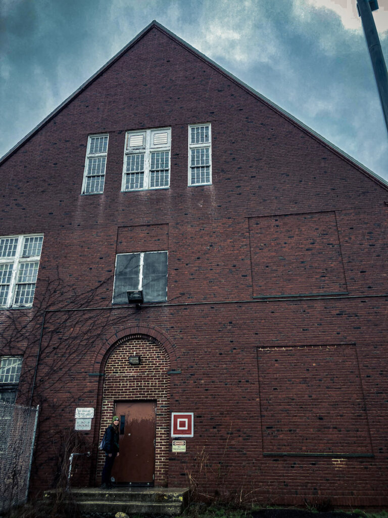
Welcome to Mid Orange County Correctional Facility
Of course, when I went, it was the middle of the day, so significantly less spooky than in the dead of night. I’d heard “oh, it’s haunted” prior to visiting, but had no idea how haunted certain individuals claim this facility to be.
Way back in March, I was first introduced to Mid-Orange County Correctional Facility (we’ll call it MOCCF) by a close friend of mine, Lily. We were talking about visiting abandoned locations (I’d mentioned Concrete City and the Pines Resort) when she brought up MOCCF. Intrigued, I agreed to check it out with her sometime.
Why Is It Always Gloomy When Visiting Scary Places
The day of our adventure was gloomy. Cold, rainy, and damp. We weren’t going to let that spoil our fun though, so off we went. Currently, the facility is also home to a sports complex. It is literally the most bizarre thing. There’s just a soccer field in the middle of the courtyard, with spooky buildings surrounding it. Imagine it: being a kid playing soccer in an old haunted prison. Knowing myself, I’d probably have nightmares. Anyway, Lily and I planned on seeing what we could get into.
Unbeknownst to us at the time, there’s a proper ghost tour you can sign up for. That’s not an ad, I’m not receiving any commission or anything from GhostHuntersUSA, it just seems fascinating. The cottages were a breeze to get into. My best guess is that the tour set it up for people to go in/out of some of the buildings easily. However, it was impossible to get into any of the bigger buildings, including the mess hall and school. In the reformatory days, people called them “cottages,” so I refer to them as such. They’re really like tiny dorms.
When entering places like this, I’m always sure to have an N-95 mask, pepper spray, and a camera. To me, it’s important to document that stuff. I’d recommend an N-95 mask because old buildings are usually full of asbestos. Personally, I like to bring pepper spray for self-defense.
Albert
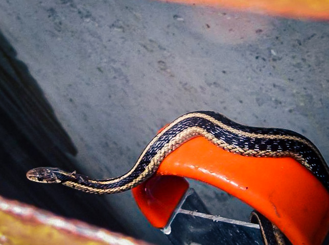
“What we could get into” apparently entailed a very close call with a snake, to really, ya know, get that adrenaline pumping. We’d hardly gotten out of my car and onto the property when we discovered a door to a basement/crawl space area that was chained, but still partially open. Lily reached her hand behind the door and started pulling, to no avail. I peeked in with my flashlight, and just as she was about to put her hand in again I stopped her. There, vibing on an orange traffic cone not 6 inches from her hand was a little snake. We decided to name him Albert. While neither of us is the best at identifying snakes, I’m at least pretty sure it was just a garter (non-venomous). I’m absolutely shocked it didn’t attack her the first time she stuck her hand back there, especially given how close she was. Great start to the day.
Albert the snake
Actually Visiting the Mid-Orange County Correctional Facility
Lily walks across some rafters
The first cottage was a bit intimidating to get into. We walked all the way around it before finally seeing a staircase that led up to an open window on the second floor. A bizarre mixture of eagerness and apprehension filled my body as we climbed up and into the window. The first thing I noticed upon entering was the lack of graffiti. Normally, places like this are COVERED in artwork, innuendos, and curse words. I felt a strong sense of unease as Lily dropped down from the window behind me. We started exploring, intrigued by how nice the place looked, even after years of abandonment. Somehow it looked like the average 2nd story of a house, not the traumatizing prison we were expecting.
After seeing the second floor, we decided it was time to make our way down to the first floor. My heart was pounding out of my chest at this point because I need to have an easy escape route when exploring these types of sites, and I already knew the only exit was the window we had climbed in. On the second floor.
Nevertheless, Lily, the bolder of the two of us, marched down with me a few feet in tow.
Correctional Facility Kayaks?
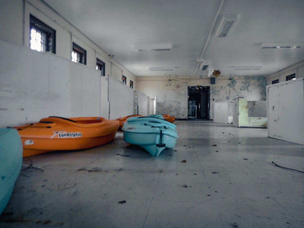
There, we found the dormitory. Later, I learned that the upstairs was where the guard of the cabin would stay while all the prisoners remained on the first floor.
Overall, the dormitory was pretty standard, except for the fact we discovered a bunch of kayaks in one of the larger rooms. Like, nice kayaks. And the room was very reminiscent of Orange is the New Black– a bunch of beds in cubicle formation in a large room. Fascinating. I suppose the sports facility is using some of the dorms as storage space.
Kayaks in the dorm?
After fully investigating the first floor, we left that cottage to check out some of the other ones.
The Other Cottages
The Weird Upstairs Bathroom
While the cottages were identical for the most part, there were a few that stuck out. First, there was one where the entire upstairs had a LONG mirror with multiple sinks, and sports team insignias painted on the walls. The wall was covered in turquoise blue bathroom wall tiles. To me, it seemed to be only recently that they were added. It was a bathroom of sorts, but with very few toilets/showers. Just that long mirror and sinks.
The next that stood out was a basement. Some of the cottages had basements, others, not so much. This one was interesting because it seemed to be a workshop of sorts. There was a cabinet with places to store tools, a bunch of electrical stuff, and insulation tubes. I got extremely weird vibes from that one; and protested when Lily wanted to go up to the first floor.
We did, however, first take the opportunity to have a lightsaber battle of sorts with rolls of some kind of building material. In retrospect, that probably wasn’t the best idea, but it was a blast nonetheless. I honestly can’t even remember who won; but rest assured we both smacked each other a good deal. Looking forwards to another match in the future at another unsafe abandoned building.
Our “Ghostly” Encounter (If You Can Call It That)
Perhaps our closest thing to a “ghostly” encounter was in one of the back cottages. Upon entering, Lily and I felt the air change around us, inexplicably. There was a fan blowing, in spite of there being no wind outside, and it stopped as we approached. Only when we backed away from it did it resume its hum. Given the lack of electricity and wind, it was definitely a bit on the spooky side. We Noped our way out of that cottage, and onto the next one.
While we were still questioning the fan, Lily and I came across some really fascinating paperwork on one of the desks in the next cottage. Paperwork! From when the correctional facility was still up and running! There were lists of prisoners, signed papers from the warden, and a whole bunch of information I felt shouldn’t be there. In hindsight, the paperwork was probably put there as a prop from the ghosthunting tour, but I’m going to keep believing it was from the desk of the warden himself anyway.
After all the cottages, we tried getting into some of the larger buildings. Unfortunately, they were locked. Sensing our adventure had come to an end, we returned to the car and left, hoping a friendly spirit hadn’t decided to follow us home.
Photo-Op moment
At some point, I would love to go back to the Mid-Orange County Correctional Facility. If I’m feeling brave enough, maybe one day I’ll do the tour to find out more about this spooky facility.
I suppose my holiday in Ithaca this past summer started unlike a vast majority of other adventures: on the side of a highway, singing karaoke into a portable Bluetooth microphone for passing (albeit, confused) drivers. My family vacations every summer tend to be a bit on the bizarre side, but that officially takes the cake. My Uncle’s tire had popped, so we all sat on the side of I-86, entertaining ourselves in the best way. While I’m referring to this as an ~Ithaca~ trip, I want to note that we spent time in the surrounding area, too. That includes Corning, Horseheads, and Watkin’s Glen.
In spite of the unusual start, the rest of the vacation was relatively on the normal side. We arrived Friday evening and started settling into this gorgeous AirBNB. It hosted stunning interior design, a hot tub, and the largest bean bag chair I’ve ever laid eyes on. For dinner, we went to Giuseppe’s pizzeria, then returned to the Airbnb for rest in prep for our long weekend.
Bright and early Saturday morning (11AM), we went to our first stop of the trip: The Corning Museum of Glass. The late start was partially due to how my family functions, but also because my Uncle had to get a new tire for his car. He was still driving on the donut up till that point.
The Corning Museum of Glass
Let me tell you a bit about the Corning Museum of Glass. We spent FIVE HOURS in there, and I would’ve been thrilled to spend another 5. From the exhibits, to live fire-blowing demonstrations, to making your own (!!) glass, the Museum of Glass quickly became my favorite museum. We passed on the opportunity to make our own glass, but I fully intend on returning at some point to give it a go. Seeing the museum online was nothing like visiting in person. I highly doubted that there would be THAT much to show for glass, but boy oh boy was I wrong. We didn’t even get to see everything. The museum also has a ginormous gift shop with everything: ornaments, Corelle plates, glasswork, and a crystal Monopoly gameboard selling for $1000. It’s honestly a lot to take in.
My favorite exhibit was an installation depicting major city populations over the course of history. Empires rise and fall, how the black plague affected Europe, the baby boom, and the migration of humanity overall. Super fascinating exhibit.
Watkins Glen
The most anticipated day of the trip for me was the day we got to visit/hike Watkin’s Glen. A few people I knew in college had visited a few years prior, and after seeing the incredible photos of the Glen on their Instagram, I immediately added it to my bucket list. Words don’t do it justice, and photos only do a marginally better job. It’s about 3 miles, round trip, and be prepared to climb because there are a lot of stairs. Word of advice: time what time you visit the Glen. We went on Sunday, and to say it was popping would be an understatement. Most of the time we were there was spent standing in line, single-file, waiting to walk up. And, as per my family, we didn’t get there till about mid-day. I’d recommend getting there early/on a weekday to avoid people/be able to enjoy the natural beauty with fewer interruptions.
Watkins Glen from Above
The Glen completely blew me away with its beauty, however, I do want to make a quick note about it. There is danger in all aspects of nature, and The Glen is no different. Watkins Glen is a falling rock zone, and it’d do everyone well to take it seriously. At one point, a rock landed mere inches from where I was walking. Had I been a step further, it very well would’ve landed on my head. While I don’t think it would’ve knocked me out, I do think I would’ve gotten a nasty wound from it. So overall, just be careful when out in nature.
Ithaca Falls: 150ft of Beauty
After our hike up and down the Glen, we drove to Ithaca to check out Ithaca Falls. The Falls is a stunning 150-foot waterfall, a mere 5-minute drive from downtown Ithaca. In addition, it’s shockingly accessible–visible from the road and requires only a three-minute hike to arrive at the base.
Ithaca Falls (look how small the people look!)
Swimming in Waterfalls? Yes, Please.
Day 4 of the trip was much more laid back. First, we drove to Lower Enfield Falls for the opportunity to swim in a waterfall basin!! We originally wanted to go to Buttermilk Falls for our waterfall swim but unfortunately, they were doing some kind of work so the whole waterfall was literally…. a trickle. At best. So to Enfield Falls we went! I am… not a fan of cold water. In spite of that, I braved the icy waters for a good ten to fifteen minutes. I then promptly decided my time was better spent on dry ground. Good move on my end. Will I swim in a waterfall basin again? Most definitely. Will I try to last a bit longer than fifteen minutes? I’ll think about it. Nevertheless, extremely grateful for the opportunity.
Swimming in a Waterfall Basin
From Enfield Falls, we drove to the other side of Robert H. Treman Park to check out Lucifer Falls. We could have hiked the 2.5-mile trail to get there but most of my family was not up for the rigorous hiking that would require. So instead, we drove 10 minutes and hiked down to Lucifer Falls, which was MUCH easier. While Watkins Glen was what I was most looking forwards to, Lucifer Falls had a greater impact on me. I felt as though Lucifer Falls was a more beautiful place. Both were absolutely stunning places, but Lucifer struck me in a different way. I’m not sure what made it stand out: the jaw-dropping height of Lucifer, the flowers, or the absence of tourists. Perhaps all of the above. I wish we’d gone earlier and spent more time there.
Good ol’ Lucifer Falls
Downtown Ithaca on a National Holiday
To finish the day, we took some time to experience downtown Ithaca. We should’ve planned that better because it was the 4th of July meaning almost every place was closed. Lesson learned there. The place we went to for dinner was SO busy because everywhere else was closed. It ended up taking us over 1.5 hours to get our food. From someone who’s been in the service industry, it’s not their fault, but regardless a bit of a painful endeavor overall. One of those, “upset at the situation, not at you” kind of moments.
Our savior came at the end of the night: street performers. There was a group of about 10 of them playing some Irish step-dance-y songs. Their spokesperson was directing a group of a few people on how to step dance. Before I could whip my camera out, the song finished. One whirlwind of a moment later, I found myself dancing with my family, grinning from ear to ear and laughing at the sheer absurdity of it all. In spite of the spokesperson’s best efforts in teaching my family the steps, we still looked as though we had two left feet. Not only was that the most spontaneous moment of the trip, but also the most unforgettable. Breathless and full of adrenaline, we thanked (and tipped!!) the performers after our jig was up. On the drive home, there was a lot of laughter over our failed dance moves.
Finishing off on a High Note
We closed the night off with some sparklers and a powerful speech from my cousin Julia, criticizing our country for taking away the rights of women through the overturning of Roe v. Wade. It was a very apt speech for a 4th of July celebration. That’s a topic for another day though.
Day 5 marked our day to check out and drive home. My sister shoveled 4 boxes of leftovers into her mouth, somehow. We played some yard frisbee and then left to embark on our several-hour drive back home. It was a vacation well spent, and I’m left with a yearning to go back and spend more time exploring Ithaca and her many waterfalls.
Hey there! We use cookies to ensure that we give you the best experience on our website. By continuing to use this site, you consent to our cookies. For more information, please visit our Privacy Policy.